Land Cover Classification from MSS Data
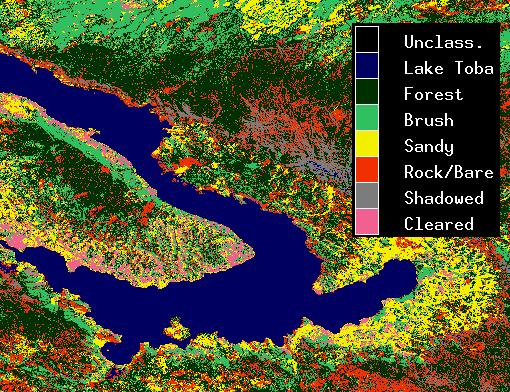
Land cover image (Lake Toba, Sumatra, Indonesia), based on supervised multispectral classification of Landsat MSS bands 1 through 4, using DRAGON. Supervised multispectral classification assigns each point on an image to one of a set of predefined categories, based on the pattern of image values across multiple image bands.
|


