Agroclimatic Assessment based on NOAA AVHRR
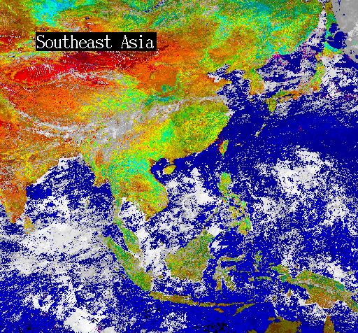
Processed image of southeast Asia, showing vegetation health as various colors (green=healthy, yellow=stressed, brown=unhealthy or entirely unvegetated). Image created by DRAGON, based on channels 1, 2 and 4 of NOAA AVHRR satellite data, using methodology developed by the NOAA Climatic Applications Branch. This technique has been used to support famine early warning systems in Africa and Asia.
|


